STEVE JACKOWSKI

fr.stevejackowski.com (site en Français)

  • Life & Work
  • Novels
    • The Swimmer
    • The Misogynist
    • The 15th Juror
    • The Shadow of God
    • The Silicon Lathe
    • L'Ombre de Dieu
    • Ethics
  • Blog
    • Electric Vehicles (EVs)
    • France
    • Personal
    • Sports
    • Startups
    • Work in Progress
    • Writing
  • Reviews
    • The Misogynist
    • The Shadow of God
    • The Silicon Lathe
  • Picture Gallery
  • Contact
  • Work in Progress

Jaizkibel - Hike from a Ruined Spanish Parador

6/26/2015

2 Comments

 
Picture
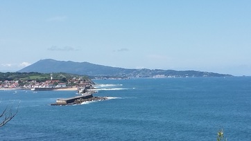
Jaizkibel seen from St Jean de Luz looking over Socoa
I've written a few blogs about les Trois Couronnes, one of the majestic peaks that dominate the Pays Basque in France.  I've also mentioned La Rhune, a higher peak to which many of the Basques attribute supernatural occurrences.  These two dominate the skyline to the south.  But there's one more that rises out of the ocean just below the border.  It's called Jaizkibel.  While we know quite a bit about the first two, we'd never hiked Jaizkibel.  It was a Saturday with rain forecast to come in about noon.  I had hoped to hike west of San Sebastian near the town of Itziar - an area called Itxaspe.  The cliffs are spectacular, the rock formations date from ancient periods, and to be honest, it appears there are some 'undiscovered' perfect point and reef breaks there if you're willing to descend the three hundred foot cliffs. 

Picture
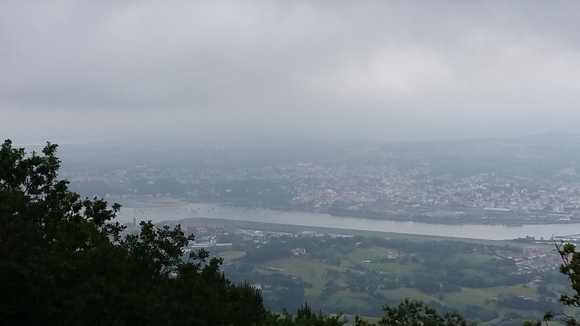
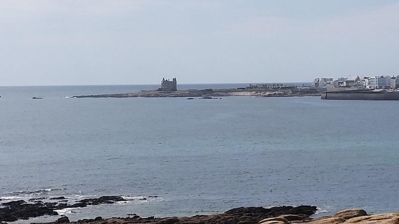
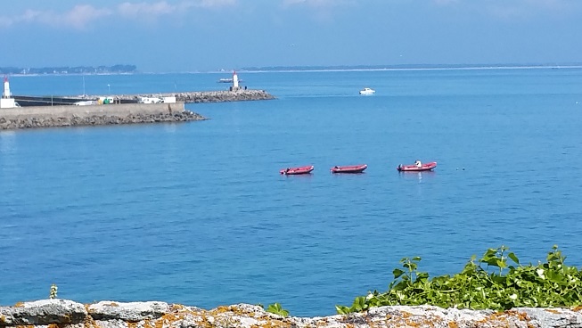
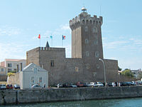
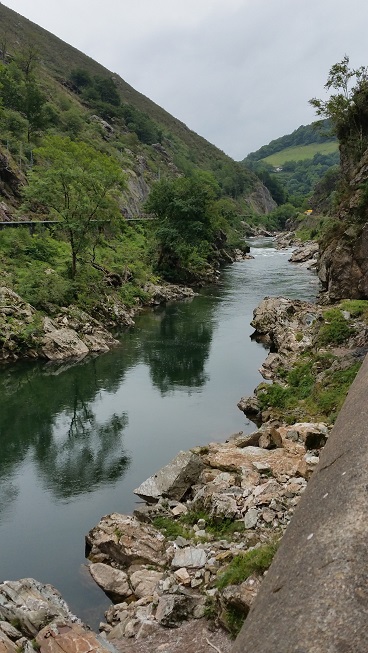
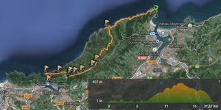
Hondarribia to Pasaia
But because of the forecast rain, Martine, our hiking partner, suggested we do Jaizkibel instead.   The mountain is a ridge that borders the ocean starting in the now-trendy Spanish town of Hondarribia.  The ocean side is rough with no roads and only trail access.  The inland side is a valley  With the Pyrenees (and Les Trois Couronnes) just a few miles to the south.  If you start at the lighthouse in Hondarribia, it's 22 km (14 miles) to Pasaia at the other end of the ridge.  Martine proposed we start about half way, at a ruined Parador, given the incoming weather. 

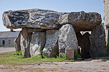
I didn't know anything about Paradors.  In our ten years together, Karen never mentioned that she had stayed in many when she lived in Spain.  Paradors are luxury hotels owned by the Spanish government which are located in old castles, monasteries, estates, and other exotic buildings.  They were built by the government to encourage the economies of out-of-the-way places.   I found a site with a map of the Spanish Paradors and clicked on several to get descriptions of the properties as well as things to do in the surrounding areas.  Karen and I will definitely be visiting a few of these (particularly in Galicia and out near the border with Portugal).

Picture
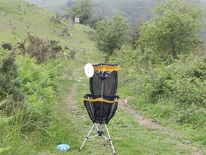
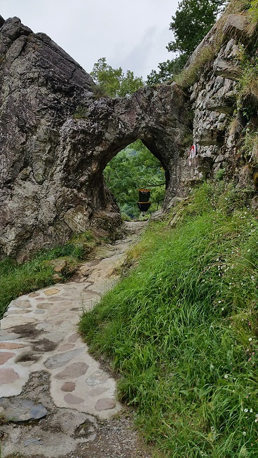
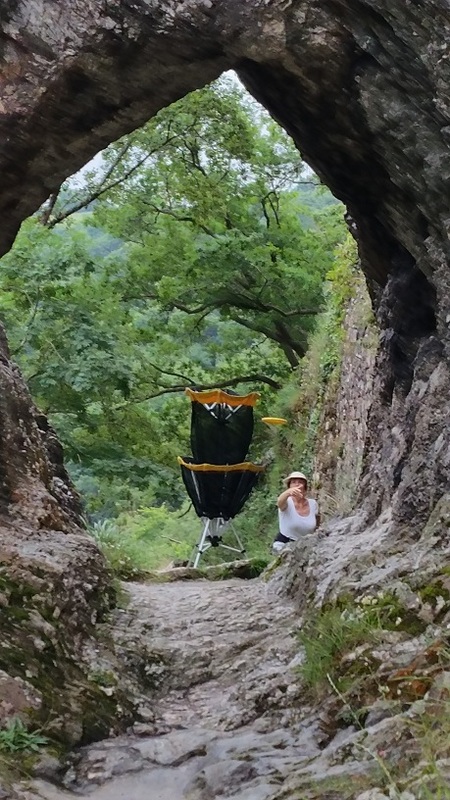
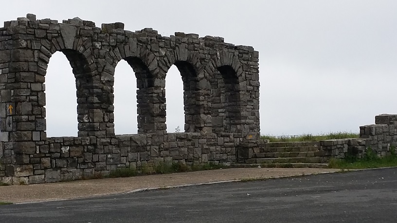
The ruins of the Jaizkibel Parador
Picture
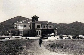
The Jaizkibel Parador before
The Jaizkibel Parador was torn down in 1999 and all that's left are some stone structures and part of the foundation.  The views are spectacular.  On the south side, you see the valley with Irun below and the Pyrenees behind.  To the north,  the rugged cliffs below, and to the northeast, Hondarribia, Hendaye, and the coastline of southwest France.  On a clear day you can see much of the way to Bordeaux.  Unfortunately, it wasn't a clear day...
Picture
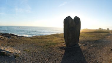
Looking south (inland)
Picture
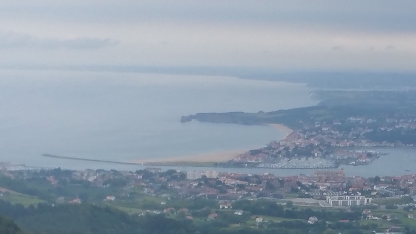
France is on the other side of the jetty
Picture
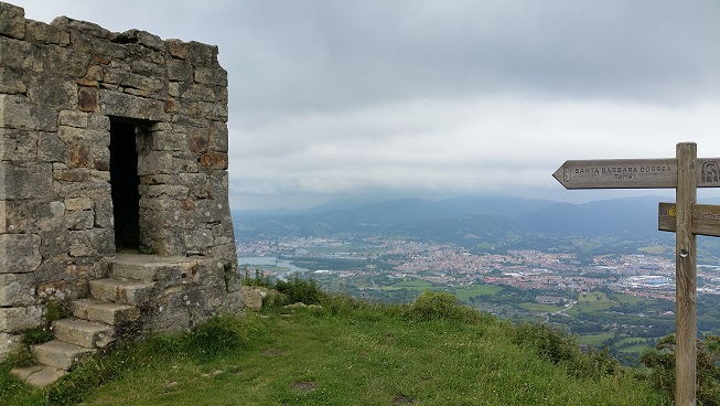
Several ancient sentinels guard the top of the ridge
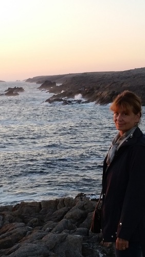
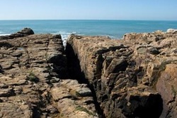
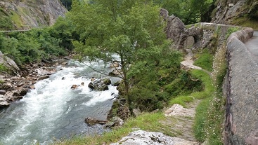
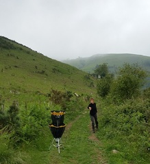
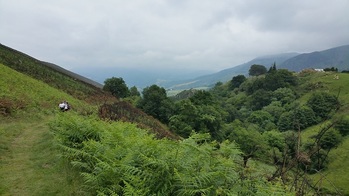
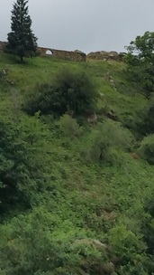
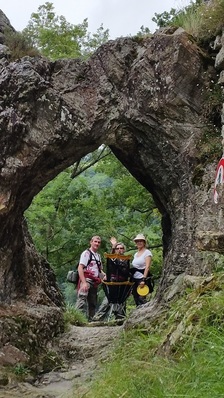
We started our hike with a descent of about 200' towards the ocean along a closed dirt road.  About a mile later after trying a small trail that led nowhere, we encountered the GR 121 - one of Europe's Grand Randonnees.  This is the 22 km trail I mentioned above.  It is a well-maintained, easy trail with gentle slopes.  We turned towards Pasaia and followed the trail into the mist as we climbed towards the peak of Jaizkibel.  Along the way we had views of the rugged, mostly inaccessible coast below us to the north and off to the west.  There were numerous trails that branched off the GR121 towards the ocean below, but given the impending weather we decided to save them for another day. 

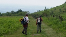
During most of our hikes in the Pyrenees, we've encountered wild horses called Pottoks.  They are small and very tough-looking.  As we climbed, we encountered a group of horses, including a foal, but we weren't sure if they were wild or not.
Picture
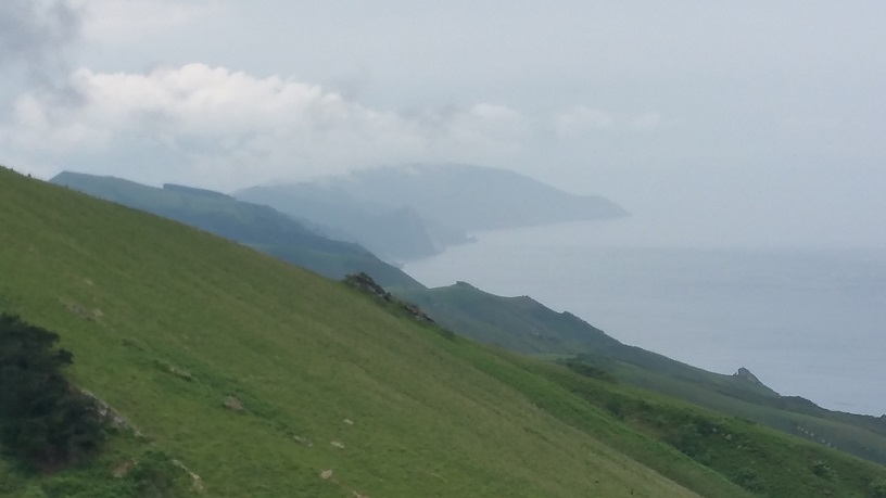
The spectacular rugged coastline to the west
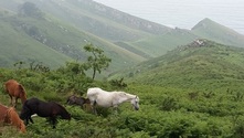
Picture
Wild (?) horses
Picture
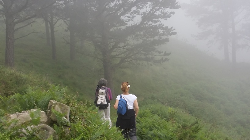
Martine and Karen heading into the mist
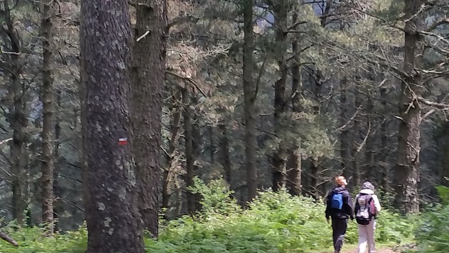
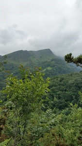
We continued upward thorough a forested area crossed by numerous creeks but decided to bypass the trail that led to the tower-laden peak, choosing instead to follow the GR 121 along the top of the ridge. 

Three and a half miles into the hike, we decided to stop for lunch at one of the ruined lookout posts similar to the one near the Parador.  We set up our lunches and of course, it began to rain, hard.  We wolfed down as much as we could under the improvised shelter of our rain jackets and decided it might be a good idea to head back.  Fortunately, about a mile later, the rain eased up and we got a few sunny breaks.
Picture
A break from the rain
Picture
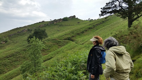
Along the ridge on the way back
Picture
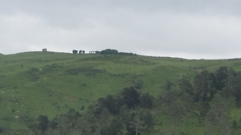
Heading back toward the Parador
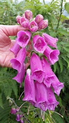
We made our way back through a few sprinkles, but it was clear from the increasing winds that the main part of the storm was on its way.  It had been nice hike of about 7 miles round trip.  In addition to the impressive views, along the way, Martine pointed out a few things of note.  The first picture below is of a very small pinkish plant that is a carnivore.  It secretes a dew-like drop that attracts insects, but is so sticky that they can't escape.  Then the leaves enshroud them.  We were able to trigger the closing with pieces of grass. 

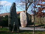
We also encountered some interesting rock formations with large hollows in them.  Martine explained that these volcanic rocks were formed with glass balls inside.  As the rocks erode, the balls become exposed, fall out, then eventually roll all the way to the ocean.
Picture
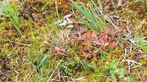
Low-lying carnivorous plants
Picture
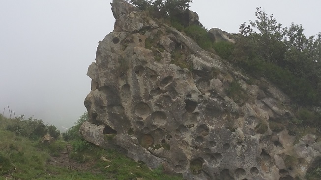
The hollows in the rock used to contain glass
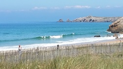
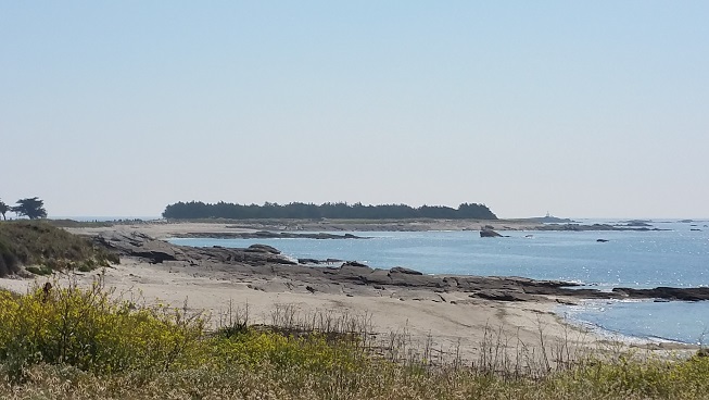
After our return, Martine send me a few pictures from one of her previous hikes on a much nicer day.  She had taken one of the lower trails from the lighthouse in Hondarribia.
Picture
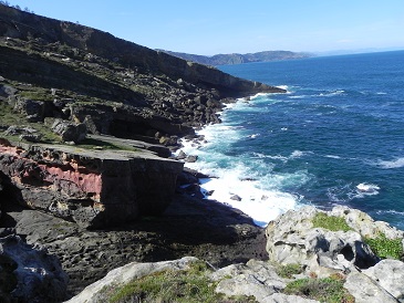
Very rugged by the water
Picture
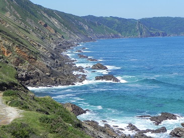
Looking west on a clear day
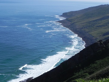
Picture
Looking northeast
As you can see, it's a remarkable area.  Most of it is inaccessible except by foot.  We're looking forward to another, longer hike at Jaizkibel starting at the lighthouse.  We'll be exploring many of the lower trails that lead into small protected coves. 

Although Les Trois Couronnes and La Rhune are still the most imposing peaks of the coastal Pays Basque, if you're in the area you should consider a hike at Jaizkibel too.
2 Comments

A Brief Trip up the West Coast of France - Quiberon

6/16/2015

0 Comments

 
PictureQuiberon in Bretagne (Brittany)
After our stops at Ile d'Oloron and Olonne-Sur-Mer, we finally reached our much anticipated Brittany.  We started with the Presqu'Ile de Quiberon.  'Presque' is the French word for 'almost', so the name literally means the almost island of Quiberon.  And it is an almost-island.  Quiberon is divided into two parts, Saint-Pierre-Quiberon and Presqu'ile de Quiberon.  The latter is separated from the mainland by a sliver-thin peninsula that is only about 70 feet wide.  Driving over this narrow stretch, it's hard to believe that with the radical tide changes in the area, the road isn't sometimes underwater making the Presqu'ile, a true island.   Still, the Presqu'ile feels like an island. 

PicturePresqu'Ile de Quiberon looking south
As you can see from the satellite photo I borrowed from the Quiberon tourism website, it's about as close to an island as you can get.  With an area of less than 9 square kilometers (less than 3.5 square miles), you can walk around the entire  presqu'ile in about 4 hours on the sentier littoral which is part of the Grand Randonnee (GR) 34.  The differences you'll see are amazing.  On the mainland side, you'll find miles of sand dunes like we've seen along most of the west coast of France.  Not far down the west side is the Cote Sauvage,  a rugged rocky coastline with just a few small beaches.  As you enter the main part of the village of Quiberon near the end of the island, you find small harbors and points which block the swells from the rest of the island, and as you round the east and northeast side of the island, you find long stretches of pristine beaches and harbors with calm crystal clear water reminiscent of the Caribbean. 

PictureKaren on the Cote Sauvage at sunset
Karen and I arrived in Quiberon mid-afternoon.  We were a couple hours early for our hotel check in but the staff was kind enough to show us to our spectacular ocean-view room.  They also recommended a restaurant called Les Viviers on the Cote Sauvage.    We drove over to the restaurant that stands alone on the cliffs, parked, and started walking the trail that runs along the cliffs for several miles, passing Menhirs, giant stones that date from about 5,000 BC.  At one point we saw a ruined chapel on the edge of the cliff and not far away was a section that was cordoned off.  It was an archeological site, a six thousand year old tomb. A sign indicated that most of the contents had been moved to the Prehistory Museum in Carnac, a few miles away. 

We had a superb dinner at Les Viviers, consisting of broiled clams as an appetizer, mussels for a main course, and very nice Muscadet from the Loire Valley.  Karen and I are mussel fans and these were the biggest mussels we've ever eaten.  It's not the shells that were unusual, it was hard to believe the meat fit inside the shells.  We walked a few more miles after dinner enjoying the memorable sunset.

Picture
View from our hotel room
Picture
One of many Menhirs along the coast
Picture
Sunset on the Cote Sauvage of Quiberon
The next morning we got up at first light and raced to Port Blanc on the Cote Sauvage to find some surf.  After a two hour session, we returned to the hotel for breakfast and then walked around the tip of the island to the east and north.  The points were lined with Cypress trees, and much of that part of the coast looked like Monterey and Pacific Grove.  As we went further east, we passed old forts and encountered new harbors and long stretches of those beaches I mentioned.  It was hard to believe how clear the water was - this was the North Atlantic Coast!
Picture
High tide and onshore in the afternoon
Picture
Heading east on the Sentier Littoral
Picture
Small harbor and clear water - northeast
We were a bit reluctant to leave Quiberon and wanted to explore more but decided to make a stop at Carnac a few miles onto the mainland to have lunch and to check out the museum and the local Menhirs.  Karen and I are not big museum people but the Prehistory Museum in Carnac was fascinating, probably because it represented local history and prehistory starting 450,000 years ago.  In addition to the finds, it chronicled the changes in the land mass, the effects of the ice age  (which at one point froze the English Channel), and showed on maps where to go to see the original sites.  It explained the construction of the Dolmens, tombs dating back to 5,000 BC, and how the massive stones were placed on top - they filled the area with dirt, dragged the stones onto the dirt and then removed the dirt.  It also proposed numerous theories for the more than 4000 menhirs in the area and their unusual alignments. 
Picture
Dolmen near Carnac
Picture
Menhirs a few minutes from the Museum
We left the museum and had a leisurely drive to our next stop, Finistere - land's end (or world's end) depending on your interpretation.  That is where we got a sense of how rugged Brittany can be.  Quiberon, even with its remarkable coastline was tame in comparison to what we'd see next. 

There's no question we'll be back to visit Quiberon and the surrounding area.  Between the beaches, the history, the great food and the surf, it's a place we want to take more time to explore.
0 Comments

A Brief Trip up the West Coast of France - Olonne-sur-mer

6/12/2015

1 Comment

 
PictureOlonne-sur-mer
The real target of our trip was Brittany so after the Ile d'Oleron, we picked a point about half way: Olonne-sur-mer.  I knew there was surf in the area, and from the photos and the bit of research I did, the place looked interesting. 

There are miles of beaches ranging from very rugged rocky areas to large sand dunes.  Just inland from the ocean is a forest, which Napoleon had planted to protect the inland areas from the sand blowing off the coast, and just a bit further inland from the forest are marshes which are stops for migrating birds and home to many exotic orchids.

The forest and the marshes are crisscrossed by almost 75  kilometers (~45 miles) of biking/hiking trails and kayaks and canoes are available for exploring the marshes. 

The area has a remarkable history dating back 2500 years.  The Romans occupied it because of its prosperous port.  England owned it beginning in the 9th century and Richard the Lionhearted considered it his favorite hunting area in France.  

PictureView of Olonne-sur-mer
Olonne-sur-mer is a community of about 14,000 people, just 5 minutes from the city of Les Sable d'Olonne.  Contrary to its name, Les Sable d'Olonne doesn't have much sand and the city is trying to find ways to save its main beach.  There's some discussion about unifying the two communities.


We arrived at the Logis Des Maraichers Monday night after a 5 hour drive that was supposed to be half that.  Philip greeted us and showed us to our room.  The Logis has 4 very elegant rooms in a closed courtyard with an outside dining area (for breakfast), and a swimming pool.  Philip then invited us to the office where he showed us maps of the area, indicated surfing spots, and made some restaurant recommendations.  He thought most would be open since it was a holiday. 

Unfortunately, his first recommendation was closed so we chose another on his list - touted for great seafood.   I'd have to say that although the service was excellent, the food was mediocre. 
  

Main beach Les Sables d'Olonne summer
Chateau St. Clair
Ancient Menhirs
After dinner we drove around the city.  Although there is much history in the area, it seems a bit hard to find or perhaps just incongruous with the city itself.  The Chateau St. Clair which houses a museum and has a lighthouse on its tower is interesting as are the Menhirs - standing stones that may date from 9000 years ago.  But as evidenced by the photo of the main beach which I borrowed from the city's tourism site, it seems like the city is trying to take on a very modern Riviera-like look at the expense of its history.  It probably doesn't help that during World War II, as the Germans were retreating, they destroyed the port, mined the beaches, and wiped out much of the city.   

There's a nice port, but a lot of industrialization in it.  The city doesn't have much charm.  We tried to find some cohesiveness but couldn't.  Some buildings were very new.  Others probably dated from the late 1940s.  But we didn't find much that was fascinating.  Maybe we just didn't know where to look, but in  most French towns and cities, you get a feel for them right away.    Overall, Karen and I agreed that Les Sables d'Olonne felt pretty disjoint - a city trying to find its identity.  Philip, our host at the Logis, agreed.  He's British and came here several years ago in search of an opportunity near the coast.  He seems to have found it in Orlonne-sur-mer, just a few miles north of the city, as the area is popular with the British and with people from the low countries who love the biking trails.  

Picture
Rocky coastline of the Cote Sauvauge
Picture
Sand dunes south of Sauveterre
Picture
Reef and points north of Sauveterre
We got up at first light the next morning and went to one of the prime surf spots called Sauveterre.  It's also a naturist beach, though on that day, it was a bit chilly.  The surf was too small to be of interest, but with miles of sand dunes to the south and reefs from there northward, I could see the potential. 

Giving up on surf, we decided to go for a hike through the Foret d'Olonne.  Like many of the forests that Napoleon had planted along the coast, it was composed of pines growing in sand or sandy soil.  We had a nice walk, but there wasn't anything really remarkable there.

Apparently it wasn't the best time of year for bird viewing so we didn't bring our kayaks and didn't take the time to rent some to explore the marshes.  Since the area didn't excite us too much, we were anxious to move on to Brittany and our next stop, Quiberon.
1 Comment

France : Disc Golf/Hiking Itxassou, Mondarrain, Pas de Roland

6/6/2015

0 Comments

 
PictureBasket is beyond the tunnel - a bad place to miss!
It sounded like a great plan.  Pascal, one of the members of the Disc Golf Sud Landes (DGSL) club had moved to the small Basque village of Itxassou in the Pyrenees about 20 minutes inland from the coast.  He said that he'd found an area that might be great for disc golf on the slopes of Mondarrain.   Mount Mondarrain is a peak that rises about 2400 feet above the Nive river which runs through Itxassou.  Franck, one of the officers of the club suggested we give it a try today and if all went well, he would negotiate with the community of Itxassou to enable us to play there on a regular basis. 

The weather was supposed to be cloudy and moderately cool (about 70), a perfect day for some exploring in the Pyrenees.   It was a great plan.

And then it wasn't.  As promised, Franck, Martine, Karen, and I arrived at the Mairie in Itxassou at 9am to meet Pascal.  Unfortunately, he'd been called away at a work emergency and was unreachable.  We had no maps, no plan, so we asked at the Mairie.  They told us there was  absolutely no parking on the mountain (you would be towed to Bayonne some 15 miles away)and that we'd have to park in the village and hike up.  They gave us a few trail maps, and told us to park near the Fronton, so off we went.

We found the parking at the Fronton, but the maps didn't seem to correspond.  Karen entered Mondarrain into Google Maps on the new phone that she loves and we started following that to the south.  We followed the paved road for a mile or so then found a dirt trail leading up the mountain.  I say dirt, but it was mud.  We started climbing. 

PictureFranck carrying the basket, Martine with lunch
Of course we were carrying our lunches, our disc golf bags, and the disc golf basket.  Ironically, the basket was the lightest piece.  It probably weighs 5 pounds.  Franck loaded up his disc golf bag with some of our lunch and put the basket on top.  Martine decided to load up with the rest in her backpack.

After climbing a few hundred vertical feet in mud, we ultimately found what appeared to be a main trail and took that.  The walk became easier, but it was still a steep steady climb.  Most of the trail was through the forest but we had a few spectacular views of the valley below.  While the weather was ideal for hiking, the pictures aren't terribly impressive on this very cloudy day.

Two hours into the hike and about two thirds of the way up the peak, we were getting tired and hungry.  We finally encountered an open area where we stopped for lunch and a bit of disc golf. 

Picture
View from the trail up
Picture
Karen made this putt!
Picture
Hanging disc...

These baskets are a bit unusual.  They stand up without falling even with the hardest throw and as I mentioned, are incredibly light.  We've been playing with them for a couple of years here in Southwest France.  They're ideal for disc golf hiking - you can carry the basket and play disc golf wherever you want while hiking.  However, this is the first time I've seen, and according to Franck the first time he's seen, a disc hung up on a 'corner' of the basket.  I assume it's a miss, similar to landing on top of the basket, though my putt followed and Martine's hanging disc fell right in.  We'll have to ask Jack Trageser, from PlayDiscGolf  what to do about a disc hanging on the basket. 
PictureDescending the canyon towards Pas de Roland

After our break, it's fair to admit that we weren't terribly happy with our experience so far.  It had been a challenging hike and we'd found few (no) open spaces for disc golf.  We'd been on a trail with barbed wire fences on both sides.  We decided to give up on Mondarrain.  Looking at a map the Mairie had given us, we saw what looked like a park area around a place called Pas de Roland.  According to Google Maps, it was about an hour's walk. 

We retraced our steps continuing past our muddy trail, and encountered a small paved road.  We headed up the mountain on that road and about a quarter mile later found a spot on the side of the road where a few cars were parked.  Clearly, this was the parking area for Mondarrain with marked trails leading from it up the mountain.  Upon our return, I checked one of the hiking sites in the area and confirmed that this was the place to park if you want to explore Mondarrain without a very long hike.  And, it appears that about half way up from there (a 10 to 15 minute walk), we might have found several places that might have been good for disc golf.  Of course we didn't know that at the time so we continued onward towards Pas de Roland.  A local farmer assured us we were on the right track and a few hundred yards later we turned off the road onto a beautiful trail that descended gently down the side of a canyon with running water below.

Picture
Peaks across the canyon
Picture
Abandoned bergerie


PictureDigitalis stalks
We continued downward passing stands of the strikingly beautiful but deadly digitalis stalks.  These bordered most of the trails both up and down the mountain.

Karen's Google Maps was accurate and we arrived at Pas de Roland in about an hour.  This part of the Nive river is spectacular with grizzled rock outcroppings, white water rapids, and small cascades.  Karen and I have done whitewater kayaking on this technical class 3 river a few miles above Itxassou, but this spot looked particularly inviting with more pools and drops reminiscent of a California river. 

Picture
Basket at Pas de Roland

Picture
Karen with a great putt!
Picture
Calm stretch on the Nive
Picture
We tossed some discs and made our way back into Itxassou, a 15 minute walk.   As we entered the village, we discovered that there were several parking areas with well-marked trails leading up to Mondarrain as well as several other nearby peaks.  We'd added several miles to our search, not only in believing the woman at the Mairie who told us there was no parking on the mountain, but also in following her directions for parking in Itxassou.  We could have had a much more enjoyable hike if we'd never gone to the Fronton.

I can't help thinking that the woman at the Mairie misled us on purpose.  Perhaps disc golf won't be welcome in Itxassou.  Still, Itxassou is a great place to hike.  The trails are beautiful and well-marked - if you start in the right place!

 In all, we covered just over 8 miles and unfortunately didn't get to play much disc golf.  However, we're resolved that at our next opportunity, Pascal will show us where we could have played.  Only this time, he's going to carry the basket and all our bags!

0 Comments

A Brief Trip up the West Coast of France - Ile d'Oleron

6/3/2015

0 Comments

 
PictureIle d'Oleron
Now that we're finally both retired, when we're in France, we're no longer tied to a computer, multiple phone calls daily, and remote troubleshooting and support.  We can  travel outside our local region to explore other parts of France and Europe.   

We've seen much of the Aquitaine coast from the Spanish border up to Bordeaux.  From Bayonne southward, the coastline is rocky with points, reefs, and occasional beaches just below the Pyrenees.  You can read about some of our coastal hikes there in my other blog posts in the France Category. 

From Bayonne north, once you cross the Adour river, there are hundreds of miles of sand dunes reminiscent of those you see south of Santa Cruz on the Monterey Bay.  These dunes, like most of the coastline of France, are protected with beach access limited to designated passes through the dunes.  

We were curious about the west coast of France north of Aquitaine so we decided to take a quick look at several areas to see where we'd want to return for longer visits.  On the agenda were Ile d'Oleron, Les Sables d'Olonne, Quiberon, Finistere, and Perros-Guirec.  The last three are in Brittany.   I'll be doing posts on each one of these places.  The first stop was Ile d'Oleron.

PictureCestas Disc Golf
Our trip started with a disc golf tournament at Cestas, just south of Bordeaux in the Aquitaine region about two hours north of our place in the Pays Basque.   The tournament ended a bit after 5pm (Karen finished in second place for the women), and our GPS indicated a 2.5 hour drive to the Ile d'Oleron.

It was the 24th of May, and we were reminded by our teammates that it was a holiday weekend - Monday was the Pentacote, a national holiday.  We should be prepared for traffic and crowds.


Picture
The Ile d'Oleron is the second largest French Island, though the largest, Corsica, is 50 times larger, so Ile d'Oleron's size is not a claim to fame.  It's about 20 miles long by 5 miles wide.  There are many islands off the west coast of France that are almost as large.

The off season population of the island is about 20,000, but that swells tremendously during the summer, particularly in August.  

It's connected to the mainland by a 2-mile long toll-free bridge.  You can drive most everywhere on the island in 15-20 minutes, but if you have the time, I'd highly recommend exploring it by bicycle.   From what we could see, most of the hotels provide bicycles.   There wasn't much traffic on the roads, so they appeared to be safe for riding, but even better, there are over 75 miles of bike paths.  

We were pleasantly surprised that we encountered no traffic getting to the island.  We easily found our hotel in La Cotiniere, a small village on the west side of the island and after a quick shower, walked the quarter mile into the heart of the village where we looked for a restaurant for dinner.  La Cotiniere has a port that is well-known for its catches and the restaurants all have fresh fish and shellfish daily.  After looking at menus, we walked into the Assiette du Capitaine.  There appeared to be only one available table outside (where it was quite cold), and one set for 4 inside which was clearly reserved.  After a brief discussion, the owner decided to give us the 4-top inside since whoever reserved it had not shown up. 


PictureProfiteroles at Assiette du Capitaine
In France, you come to appreciate fine food.  Presentation is always exceptional and the flavors sublime.  But, I must admit that after an extended period here, I do miss spicy food.  And there's spicy-hot and spicy-complex - it's hard to find either in France.  To our surprise, the Assiette du Capitaine served fresh fish with exotic spices from the Carribean and South America.  All of their food is organic and made onsite, and the fish is fresh caught that day. Although we had several superb meals on our trip up the coast (you'll hear more in subsequent posts), without a doubt this was the best meal we had on this particular trip.  We should probably have taken pictures of our appetizers and main courses, but we were hungry, and even the best photos can't do justice to the subtlety of flavors the chef created.  Instead, here's a picture of the best profiteroles I've ever had.

Since Monday was a holiday, we knew we had to leave by mid-afternoon if we wanted to avoid the traffic across the bridge back to the mainland, so we got up early and began exploring the island. 

On the southeast corner is Le Chateau d'Oleron and its Citadel which was built in the 17th century.  If you're an oyster fan, you can take the Route des Huitres northwest by bicycle or car and do oyster tastings along the way.  According to the most of the French we've met, the oysters from the Ile d'Oleron are the best in France.    The coastline is rocky and rough with a few small beaches.


Continuing up the coast you will pass through the village of Saint Denis before arriving at the black and white stripped Phare de Chassiron lighthouse.  If you like lighthouses, there are at least 6 significant ones on the island including 3 in Chateau d'Oleron and one in La Continiere. 

The Phare de Chassiron lighthouse is open to visitors and you can see the entire island from the top of the 151' structure.   The original structure was built in 1655 but it's seen a number of renovations/enhancements since.  These are described in detail on signs as you enter the lighthouse grounds.

The lighthouse is surrounded by a garden which includes explanations of the wind patterns and their legends, memorials to shipwreck victims, and numerous sculptures.    Shipwrecks seem to be a major theme of the coast north of Aquitane. 

There are trails leading west and south from the lighthouse that extend for miles.  The coastline is all rocky reefs and points with ecusses - former large scale fishing traps - structures build of stone with netting or grills in various places.  At high tide, the water would spill over the top of the walls and at lower tide would run out through the grills/nets trapping the fish.  This type of fishing is now outlawed, but the structures still stand in the reefs.

There is good surfing here at the end of the island, but as one local said, don't go out alone and be very aware of the tides or you'll find yourself dragged all the way to La Rochelle 15 miles away. 
Phare de Chassiron
Reefs, points, and ecusses near Chassiron
Explanation of how ecusses work
PictureSand dunes and pine forests on the west coast.

As you head west and south, the rocks and reefs give way to sandy beaches near La Hutte, a well-known surf spot.  From there onwards along the west coast of the island, it's miles of sand dunes, often bordered by pine forests.  Like the rest of the French coast, the dunes are protected, but there are plenty of passages to the beach.

We spoke with several people about the island, tourism, crowds, etc., and indeed, during late July and August, there are continuous traffic jams on the island.  Much of the island is now home to camping parks and these fill up quickly.  But, just a bit off-season, there are very few people, and empty beaches, roads, and bike trails.  Even during our holiday weekend, it seemed pretty deserted. 

PictureFort Boyard
We were a little pressed for time since we hoped to avoid the holiday traffic leaving the island so we cut our visit short.  If we'd had more time, we probably would have explored by bicycle instead of car and we would have taken a couple of days to do that.  We would have spent time in Chateau d'Oleron and probably would have taken the boat trip to Fort Boyard, a strange looking fortress in the channel separating the island from the mainland.  We would have visited the Port des Salines to learn about salt production.  And, we would have sampled more restaurants.

We left the island mid-afternoon, but in spite of our early departure, spent a long time on the bridge to the mainland and even more getting through La Rochelle (there was a huge flea market that had roads backed up for miles).  Our projected 2.5 hour trip to Sables d'Olonne (my next blog post), took nearly double that.

Would we go back to Ile d'Oleron?  Yes, but it would be off season - May/June or late September/early October.    The food was memorable and since our return, I've heard from others that the Ile d'Oleron has some of the best seafood in France.  And, I must admit that I'd like to see if I can find some uncrowded off-season surf there.

0 Comments
    Picture

    Steve Jackowski

    Writer, extreme sports enthusiast, serial entrepreneur, technologist.

     
    Check out my latest novel!
    Picture

    Categories

    All
    Electric Vehicles (EVs)
    France
    Personal
    Sports
    Startups
    Work In Progress
    Writing

    RSS Feed

    Archives

    September 2022
    June 2022
    October 2021
    June 2021
    October 2020
    September 2020
    May 2020
    December 2019
    November 2019
    September 2019
    August 2019
    July 2019
    June 2019
    May 2019
    October 2018
    September 2018
    June 2018
    January 2018
    November 2017
    September 2017
    August 2017
    June 2017
    April 2017
    March 2017
    January 2017
    December 2016
    November 2016
    October 2016
    June 2016
    April 2016
    March 2016
    December 2015
    July 2015
    June 2015
    May 2015
    March 2015
    February 2015
    January 2015
    December 2014
    November 2014
    October 2014
    September 2014
    August 2014
    July 2014
    June 2014
    May 2014
    April 2014
    March 2014
    February 2014
    January 2014
    December 2013
    November 2013
    October 2013
    September 2013


Proudly powered by Weebly

BACK TO TOP

Plain & Simple Web Design © 2013