Who knew that megaliths, menhirs, dolmen, and cromlechs lay just a few minutes away from our place in the Pays Basque? I described some that we saw in Brittany in my post A Brief Trip up the West Coast of France - Quiberon. Those were certainly impressive as were the associated museums that explained how they came to be. But yesterday, we came upon local prehistoric structures during a hike in the Pyrenees just across the Spanish Border.
Our friends Elaine and Jean-Luc invited us to visit Sare, a small Basque village at the foot of the Pyrenees where they claimed we could find the best gateau Basque in the region. If the weather was nice, they proposed a short hike/walk from the village up towards the GR10 for some picturesque views, followed by a visit to the witches village, followed by a hike in an area they had recently discovered. The GR10 is the Grande Randonnee trail that runs from the Atlantic to the Mediterranean along the Pyrenees - about 900 km (560 miles).
We had agreed that if the weather was bad, we'd visit the famous caves of Sare and those in the witches' village. As it turned out, the day was overcast but comfortable, with the temperature about 70 degrees (20 C) - perfect weather for a hike. Rain was forecast for late that night into the next day. We decided to pass on the caves for this trip.
Karen and I encountered heavy Sunday morning traffic getting to Ciboure where we were to meet up with Elaine and Jean-Luc, so it was a bit later than expected when we left their place to begin our explorations. After a 15 minute drive, we were in Sare.
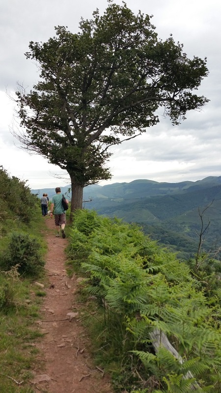
Parking on a side street, we followed the signs towards the GR10. Not far into our walk, we realized that there was a mountain bike competition going on as riders descended the trail at breakneck speeds towards the finish line on the fronton in the village. We spoke to some of the trail monitors who told us that only about half the field had passed them so far. So instead of continuing up the trail, we made our way back to the village where we realized we were hungry. We visited all of the open restaurants but couldn't resist the tempting dishes we saw being served on the terrace of the Hotel Arraya. The service and food were excellent and as often happens with French meals, wine and dessert extended what was supposed to be a brief stop into a 2-hour lunch.
We had agreed that if the weather was bad, we'd visit the famous caves of Sare and those in the witches' village. As it turned out, the day was overcast but comfortable, with the temperature about 70 degrees (20 C) - perfect weather for a hike. Rain was forecast for late that night into the next day. We decided to pass on the caves for this trip.
Karen and I encountered heavy Sunday morning traffic getting to Ciboure where we were to meet up with Elaine and Jean-Luc, so it was a bit later than expected when we left their place to begin our explorations. After a 15 minute drive, we were in Sare.
Parking on a side street, we followed the signs towards the GR10. Not far into our walk, we realized that there was a mountain bike competition going on as riders descended the trail at breakneck speeds towards the finish line on the fronton in the village. We spoke to some of the trail monitors who told us that only about half the field had passed them so far. So instead of continuing up the trail, we made our way back to the village where we realized we were hungry. We visited all of the open restaurants but couldn't resist the tempting dishes we saw being served on the terrace of the Hotel Arraya. The service and food were excellent and as often happens with French meals, wine and dessert extended what was supposed to be a brief stop into a 2-hour lunch.
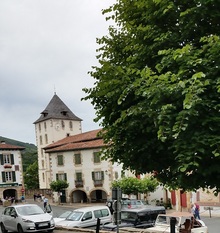 The village of Sare | 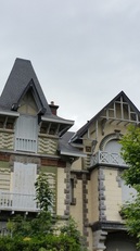 Interesting Architecture in Sare | 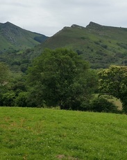 View from the trail leaving Sare |
Afterwards, we stopped at the gateau Basque stand next to the hotel. We bought our gateau Basque, hopped in the car, and made the short drive up to Zugarramurdi, the witches' village. We could have conceivably made the 7 km hike, but after such a nice lunch...
Zugarramurdi, the witches' village, is the Spanish equivalent of Salem, Massachusetts. Based on occult events beginning in 1609, purported witches from the village were tried and burned at the stake. There was a region-wide inquisition of over 7,000 accused women, children, and even certain priests who wore medallions with images of saints. Today, the village embraces its history with caricatures of witches' faces on stones, buildings, and road signs, and witches' brooms hanging above entrances to buildings. During the summer solstice, which is considered the witches' day, huge fires are lit in caves not far from the village. These are visible from the surrounding countryside in both Spain and France. In August each year, the deaths of those burned at the stake are remembered with a feast of roasted lamb in the caves. The lamb is roasted on stakes.
Zugarramurdi, the witches' village, is the Spanish equivalent of Salem, Massachusetts. Based on occult events beginning in 1609, purported witches from the village were tried and burned at the stake. There was a region-wide inquisition of over 7,000 accused women, children, and even certain priests who wore medallions with images of saints. Today, the village embraces its history with caricatures of witches' faces on stones, buildings, and road signs, and witches' brooms hanging above entrances to buildings. During the summer solstice, which is considered the witches' day, huge fires are lit in caves not far from the village. These are visible from the surrounding countryside in both Spain and France. In August each year, the deaths of those burned at the stake are remembered with a feast of roasted lamb in the caves. The lamb is roasted on stakes.
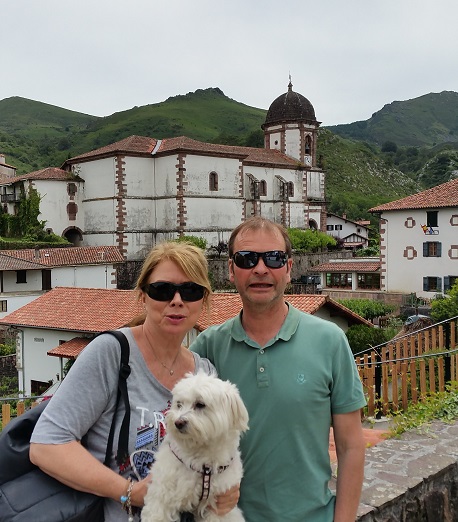 Elaine, Jean-Luc, and Coco | 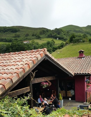 Auberge with witches' broom |
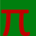
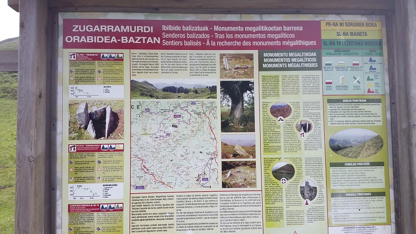
After exploring the village, we stopped at a cafe across the small plaza from the Church of the Assumption for coffee (sparkling water for me), and our gateau Basque which was as good as promised. We took the narrow road up the hill a short distance to the place where Elaine and Jean-Luc had hiked before. They suggested we try a different trail, one on the right (west) side of the road. There was a large sign in Spanish, Basque and French that described several trails. Looking at the time, the thickening clouds, and recognizing that we had probably had too much food, we decided on a 5 km loop. We didn't even think about what the red, 'pi'-like symbol was at the top, but were surprised to find that there would be megaliths along the trail.
We started out on what looked like a well traveled path, but as we turned up the hill past an abandoned bergerie, the trail thinned and markings were hard to find. We pushed on, assuming we had to get to the saddle on the top of the ridge. Along the way, we passed groups of Potoks, the small horses that live in the Pyrenees.
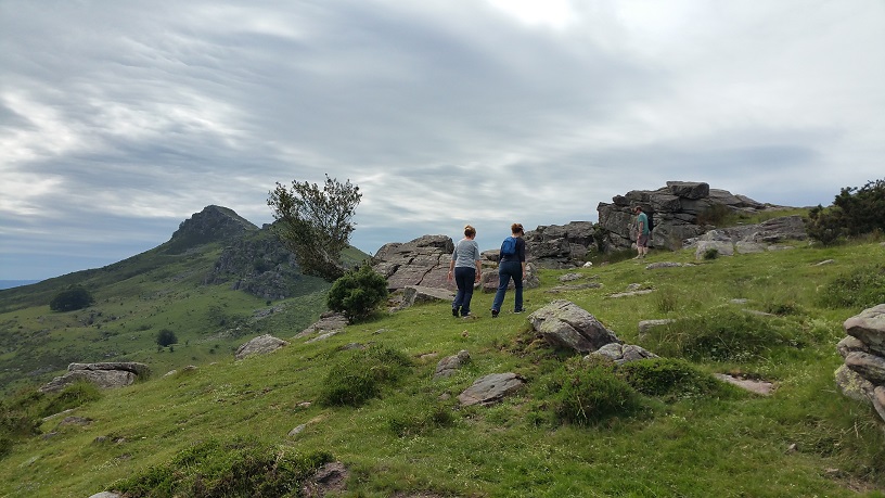
Once we reached the middle of the saddle, we couldn't easily determine whether to turn right or left. I went left, Jean-Luc went right and about 100 yards from the saddle, Jean-Luc found a trail marker so we went that way. If you go, when you reach the saddle, turn right (west). Thereafter, the trail markers were easy to find.
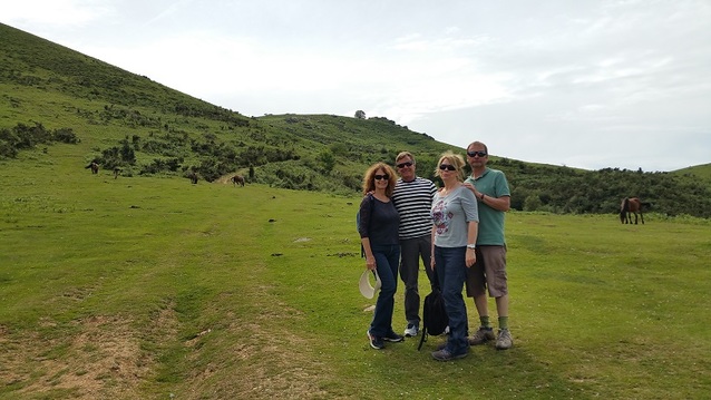
Karen, Steve, Elaine, and Jean-Luc about to start our hike
 Looking down on Zugarramundi from the trail | 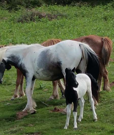 Potoks on the way up |
Jean-Luc, Elaine, and Karen nearing the top of the saddle
Nearing the peak west of the saddle
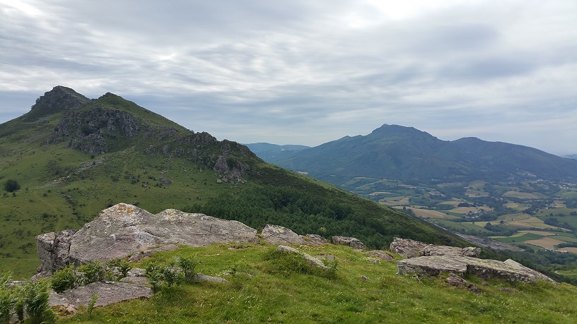
View of La Rhune from the peak west of the saddle
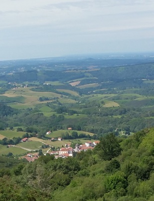
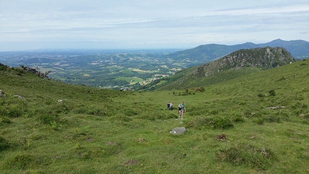
Climbing towards the west peak of the saddle, we had not only spectacular views of the French coastline and La Rhune, but of Spain to the south and the Pyrenees to the east. We began our descent into a beautiful valley.
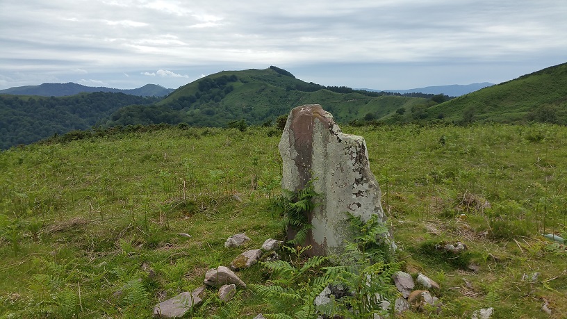
Near the bottom of the hill, we saw our first marker for cromlechs. Before I continue, let me give you a few definitions. A menhir or megalith is an upright stone. Most are flat. Notable ones are several feet high, but sometimes they can be quite small. A dolmen is a structure build of megaliths. They usually have at least two upright stones with a flat capstone on top. Most were used as burial tombs. Some of the ones we saw in Brittany were huge. It seemed like a feat of engineering to raise the capstones, but in fact, the process was quite simple. After the side stones were placed, they filled the space between and around with dirt. They dragged the capstone onto the top of the mound, positioning it above the 'walls'. Finally, they dug out the earthen mound leaving a stone structure - no pulley needed to raise a stone weighing many tons several feet to place it on top.
Finally, a cromlech is a circle of menhirs or megaliths. Stonehenge is probably the most well-know cromlech. It appears no one knows exactly what cromlechs were used for. At least that's the case outside the Basque region. Theories abound. But in the Basque region, archaeologists have concluded that these are burial site markers, often with a dolmen in the center. Most of these structures were built between 4000 and 2000 B.C..
Continuing on our hike, we saw the marker for the cromlechs, but the cromlechs themselves weren't easy to spot. Unlike Brittany where these monuments are well-maintained, those before us were buried in the ferns and tall grasses. Plus, after 5,000 years of neglect in lightly traveled areas, most of the structures have fallen down or been eroded by the elements and severe storms of the Pyrenees. Somehow though, finding these structures out in the middle of nowhere seemed more authentic.
A collapsed dolmen
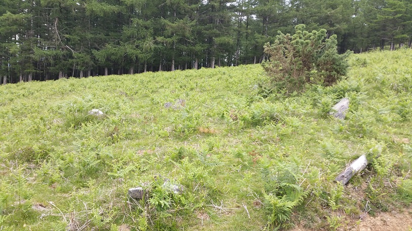 Cromlech hidden by vegetation | 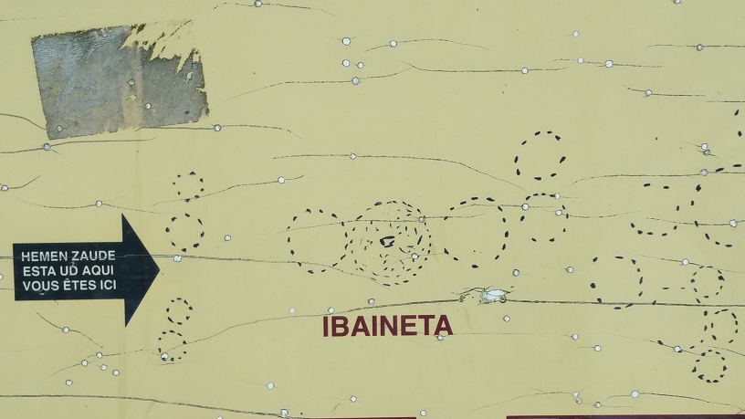 Cromlech layout |
Leaving the cromlechs, we continued south along the trail through meadows, crossing streams, and entering the forest after the trail turned east to begin our loop back. We passed a few bergeries and with the thickening clouds, began to wonder if we'd make it back before the rain started. As we passed the 5 km point as indicated by Karen's Garmin, we still seemed to be quite far from our starting point. But the trail was well-marked and there really weren't any alternatives unless you were a mountain goat, so we pressed on.
We crossed a boulder-filled creek next to a small waterfall and soon found ourselves on the edge of a the ridge that would lead us back to the car. As we passed one final bergerie, the first few drops began to fall, but the car was in sight. We got into the car, closed the doors, and the sky opened up. Somehow even with the morning delays, the long lunch, and some trail misdirection, we'd timed it perfectly. The hike was a bit over 6 km (not 5 km as promised by the sign), and it had taken us 2 hours including pictures and exploration of the cromlechs. According to the sign, there are 7 km and 10 km monument hikes nearby. We'll be going back and will allocate more time to explore.
We crossed a boulder-filled creek next to a small waterfall and soon found ourselves on the edge of a the ridge that would lead us back to the car. As we passed one final bergerie, the first few drops began to fall, but the car was in sight. We got into the car, closed the doors, and the sky opened up. Somehow even with the morning delays, the long lunch, and some trail misdirection, we'd timed it perfectly. The hike was a bit over 6 km (not 5 km as promised by the sign), and it had taken us 2 hours including pictures and exploration of the cromlechs. According to the sign, there are 7 km and 10 km monument hikes nearby. We'll be going back and will allocate more time to explore.


 RSS Feed