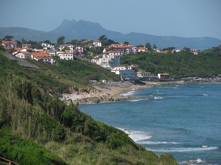
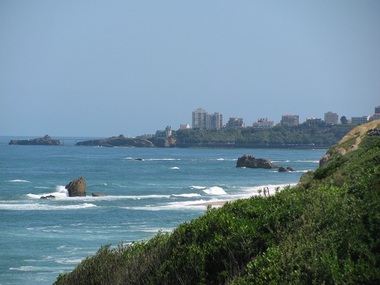
 View of Guethary looking south from just above Plage du Centre
 After a great surf session in Bidart on the north end of the Plage du Centre, I noticed that the Sentier Littoral continued up the cliff into the trees above. I realized that for all the times we've taken the Sentier Littoral into Saint Jean de Luz, and south of there from Ciboure into Hendaye, we'd never actually walked it to the north. I'd mistakenly assumed that once it got into Bidart, the village just north of Guethary, it just followed roads along the cliff with the highway not far away. Seeing this trail, I suspected I was wrong.
After a nice lunch on our mini-terrace which looked at Bidart, we decided to walk the northern part of the Sentier Litorral. Bidart is a village of about 6,000 people (about 5 times the size of Guethary). Even though it's literally across the street from us and the village center is a 20 minute walk away, we've never explored it, thinking it was much more commercial.
After a nice lunch on our mini-terrace which looked at Bidart, we decided to walk the northern part of the Sentier Litorral. Bidart is a village of about 6,000 people (about 5 times the size of Guethary). Even though it's literally across the street from us and the village center is a 20 minute walk away, we've never explored it, thinking it was much more commercial.
 Looking north from the end of Parlementia
 We left the house and walked the 5 minutes down to Parlementia which is officially part of Bidart but seems to be part of Guethary - at least to most of the locals. There's a nice trail past the La Bahia restaurant on the edge of the water which continues up the hill and onto rural streets. The picture at the left is a shot just as we were leaving the street to follow a pretty trail down to the beach below. The trail continues along the beach to the small l'Uhabia river, then along the rock border to a bridge. It crosses an open area then goes on to city streets much as we expected.
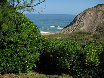
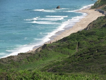
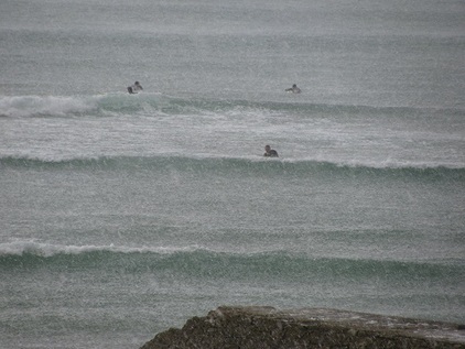 Surfers in the hailstorm
 We turned towards the Plage du Centre and stopped at the top to take a picture looking south back towards Guethary - this is the first picture in this post. Note that the sky looks clear and beautiful. Unfortunately, to the east, thunderheads had developed and it looked like they were moving our way. We took the trail down the cliff and as we stopped to watch the surf for a few minutes, the first drops began to fall. Within seconds it was pouring and marble-sized hail started falling. We sought shelter under Tantina de la Playa - one of our favorite restaurants - and waited for the hail to stop. What looks like a grainy photo is actually a clear photo. The 'grains' are hailstones. Within minutes, all the surfers had flipped their boards over and crawled under them to protect themselves from the incessant onslaught of balls of ice. After twenty to thirty minutes it stopped. Since there were clearly more storms to the east, we decided to race home where we watched a spectacular lightning show.
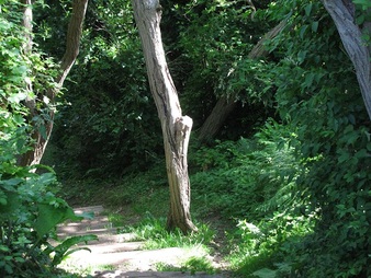
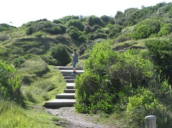 Karen on the trail up past Tantina de la Playa
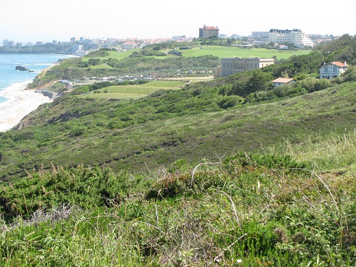
 With better weather returning, we retraced our path the next morning. We continued past Tantina de la Playa to the trail I'd seen and made our way up the cliff. We were pleasantly surprised by the vistas as the trail wound its way up to a point about 320 feet above the ocean. The trail quickly emerged onto a small city street which paralleled the cliff. Stately Basque villas and elegant four and five-starred hotels lined the cliff.
 Climbing up from Plage du Centre | 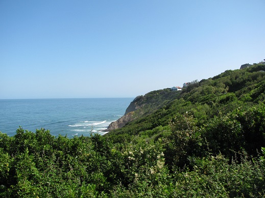 Nearing the top of the cliffs in Bidart |
Not far along the road, the trail turns left into the forest. Winding through the trees, it descends down to Erretegia beach. For years this has been a popular beach in Bidart. It's a little out of the way and is nicely tucked away from larger beaches to the north and south. Unfortunately, with the strong storms of this past winter, landslides and erosion have reduced the once extensive beach to a relatively small patch of sand. The owner of one of the surf schools told me that this has decimated his business.
Officially, the Sentier Littoral turns back up the hill along the access road to Erretegia. It then parallels the N10 highway for hundred yards before ending half a mile away on city streets.
Officially, the Sentier Littoral turns back up the hill along the access road to Erretegia. It then parallels the N10 highway for hundred yards before ending half a mile away on city streets.
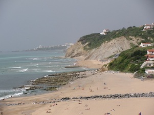
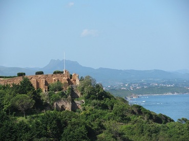 North of Erretegia beach looking south
 We noticed a much smaller trail leading north along the cliff just above the beach at Erretegia so we decided to try that. As we got to its highest point, we looked back south across Erretegia and saw this ancient structure built into the cliff above the beach.
Turning north again, the trail forked and offered an opportunity to regain the Sentier Littoral a hundred vertical feet above, but we decided to continue north along the lower trail.
Turning north again, the trail forked and offered an opportunity to regain the Sentier Littoral a hundred vertical feet above, but we decided to continue north along the lower trail.
 Lower trail from Erretegia towards Pavillon Royal
 This narrow trail wound its way down the cliff where there were several side trails dropping down to mostly-deserted clothing-optional beaches which extend to the beach below the Pavillon Royal near the border of Biarritz. The Pavillon Royal was built by Queen Natalie of Serbia in the late 19th century when she separated from her husband. It's a spectacular manor called Les Ailes (the Wings) that is now owned by the Latécoère family.
 Pavillon Royal (block shaped building) | 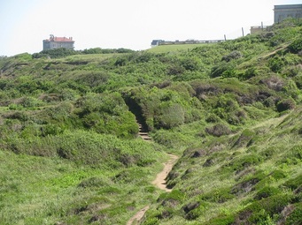 Lower trail towards Pavillon Royal |
 View of Biarritz just before heading back up to Bidart
 As we neared the Pavillon Royal, the trail turned up the hill back towards the north end of Bidart. There was another very small, overgrown trail with lots of thistles and nettles which appeared to stay on the cliff all the way to the Pavillon Royal beach and campground, but we decided to skip it since we were in shorts and running shoes.
Instead, we made our way up the hillside past an elegant hotel and on to the small side streets of Bidart. According to Karen's GPS watch, we'd covered just under 4 miles. Since we were hungry and had forgotten to buy bread, we decided to race back along the streets to our favorite bakery not far from our place in Guethary. We made it just before they closed and noted that our total distance was 6 miles.
As I mentioned, we've often done the 5-mile walk south along the Sentier Litorral into Saint Jean de Luz for lunch or a movie but never considered the walk north. Now that we've seen the beauty of the trails in the cliffs of Bidart, when we want a nearby hike (as opposed to a walk), we'll do these northern trails again.

 RSS Feed